
Drone Photography NJ: Transform Real Estate Marketing with Aerial Views
Transform your property listings with drone photography NJ, showcasing stunning aerial views that elevate real estate marketing and attract more buyers.
Why Real Estate Media Matters
Harnessing drone photography in NJ can provide a fresh angle for real estate listings, capturing aspects of properties that are impossible to appreciate from the ground. By offering a bird’s-eye perspective, sellers and agents can immediately convey a property’s setting, outdoor features, and position within the neighborhood. For New Jersey’s diverse real estate market, where every listing tells a unique story, aerial images can be the key to making that narrative clear.
Buyers browsing listings are often searching for visual clarity on how a property’s layout and amenities fit together. Standard ground-level photos offer detailed views of interiors and curb appeal, but aerial real estate photography reveals the whole picture, from lot shape to proximity to parks and transportation. This additional context is invaluable for viewers who want to understand features like expansive yards, waterfront positions, or connections to commuter routes.
Because New Jersey includes everything from busy city streets to tranquil shorelines and sprawling suburbs, real estate presentations need to communicate more than just indoor finishes. Drone photography real estate services help showcase these varied environments, highlighting what makes each property unique, whether it’s urban convenience, outdoor space, or a scenic water view.
Video, 3D Tours, and Visual Storytelling
Effective aerial imagery instantly answers questions buyers might have about a property’s privacy, scale, or access to nearby amenities. A well-chosen drone shot can display a building’s footprint, show where outdoor living areas are situated, or reveal features like pools, patios, and gardens in a single image. This helps buyers make early decisions based on factors that would otherwise be hard to describe in words.
Waterfront and shore listings in NJ can especially benefit from aerial views, which can document how a home or building relates to the coastline, nearby marinas, or access points. Instead of just wide scenic shots, the best drone photography ties the property closely to its surroundings, placing both home and setting in clear context. For buyers weighing location against lifestyle, these images provide immediate visual information.
Large lots and suburban properties with unique outdoor amenities also stand out in the aerial format. Ground photos can highlight details like pools or landscaping, but a drone photo reveals how those spaces connect and flow together across the entire lot. Homes with distinctive shapes, guesthouses, or special site placement gain extra clarity from the overhead view.
Why Agents Choose RealtaSnap
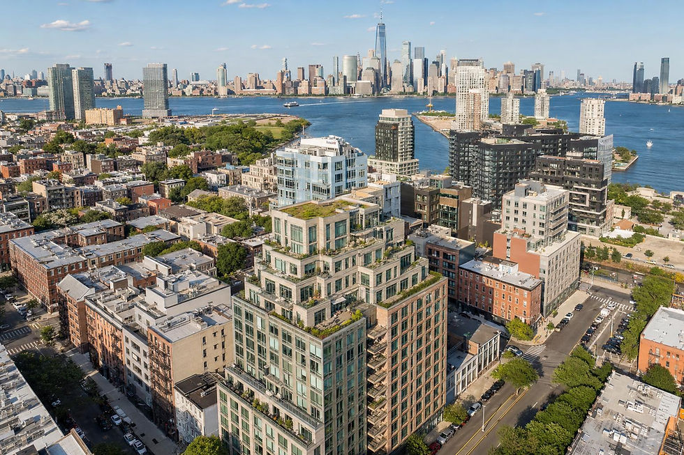
Listings in dense urban areas or near transit benefit from a top-down perspective that shows their place within the fabric of a neighborhood. For these properties, aerial shots can highlight street frontage, parking, or connections to green spaces and transit lines. However, feasibility in city locations always depends on local airspace, weather, and building access, and not every property will be flyable.
Commercial real estate marketing relies on accurately conveying access, scale, and surrounding infrastructure. With the right drone photography, stakeholders can see truck bays, parking layouts, adjacent business hubs, or major highway routes. These images answer functional questions important to buyers and tenants, ensuring marketing materials go beyond surface-level appeal.
Selecting which aerial perspectives to include matters more than volume. A practical drone gallery might combine establishing shots, closer angles on outdoor features, and broader context views that show the property in relation to local highlights. For residential and commercial listings alike, every shot should serve a purpose—clarifying space, access, or setting in a way that everyday photos cannot capture.
Fast Turnaround and Better Results
Pairing aerial photos with traditional stills, immersive video, and even floor plans can help craft a media package that addresses every aspect of a property story. Drone images deliver broad context, while interior and ground-level photography reveal daily living spaces and finishes. Together, they allow buyers to visualize both the lifestyle and the logistics of a potential purchase.
Preparing for a drone shoot begins well before the pilot arrives. Clearing outdoor clutter, moving vehicles, tidying yards, and making amenities camera-ready helps ensure the most appealing aerial images are captured. If special building access or coordination with tenants is needed, setting those arrangements ahead of time leads to a smoother process.
It’s important to communicate what you want your aerial photography to achieve. Focus on the angles or features that matter most—be it proximity to a park, a prominent corner lot, or a dramatic roofline. RealtaSnap’s booking system allows clients to note their priorities, enter property details, select coverage packages, pick appointment times, and complete payments online for convenience.
Drone operations for real estate are governed by FAA Part 107 regulations, airspace rules, weather conditions, site access, and the pilot’s assessment on the day of the shoot. Not every property can be covered by drone, particularly in locations with strict flight restrictions, and safety always takes priority. All prices and information are subject to change. Information is deemed reliable but not guaranteed.
Ready to Elevate Your Next Listing?
Ready to get started? Visit RealtaSnap to explore our services and book your next shoot.
Frequently Asked Questions
What makes drone photography valuable for New Jersey real estate listings?
Aerial images reveal the property’s setting, lot details, and relationship to notable landmarks, helping buyers quickly grasp unique selling points.
Are drone flights always possible at any property location in New Jersey?
No, each site is assessed individually for airspace, weather, safety, and authorization, so coverage is not guaranteed everywhere.
How should I prepare my property for drone photography?
Remove vehicles, tidy outdoor areas, and coordinate access so key features can be captured cleanly and without obstruction.


Comments