Discover how drone photography real estate services can highlight unique property features and when aerial views add real value, especially in NYC markets.
Why Real Estate Media Matters
Using drone photography real estate services can be a strategic decision for agents looking to show property features that standard photos might overlook. Aerial imagery helps viewers visualize elements like large backyards, unique rooflines, or access to the waterfront in a way that ground-level images cannot. By giving a clear sense of setting and scale, drone media can help buyers better understand a property’s appeal.
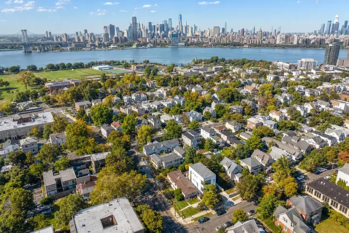
Not every real estate listing benefits equally from aerial coverage, especially in the dense neighborhoods common to NYC and some New Jersey cities. A tightly packed apartment block without significant exterior features might not gain much from a drone view. The best results come when aerial photography is used thoughtfully to reveal aspects of the property’s story that would otherwise be missed.
The main purpose of aerial real estate photography is to add relevant context to a listing, not just deliver impressive shots from above. For suburban homes with expansive outdoor spaces or commercial sites spread over multiple lots, aerial imagery often provides the missing piece of the narrative. On the other hand, listings focused mainly on interior features may be better served by professional indoor photography.
Video, 3D Tours, and Visual Storytelling
Before adding a drone session, it’s practical to ask what the aerial perspective will actually communicate to buyers or investors. Does the property’s layout, lot dimensions, or surrounding environment contribute meaningfully to its market value? If so, showing these aspects from above can make the listing clearer and more compelling.
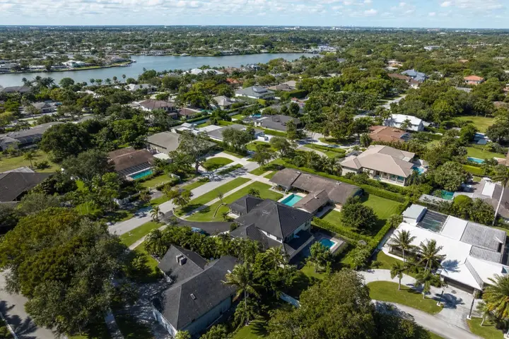
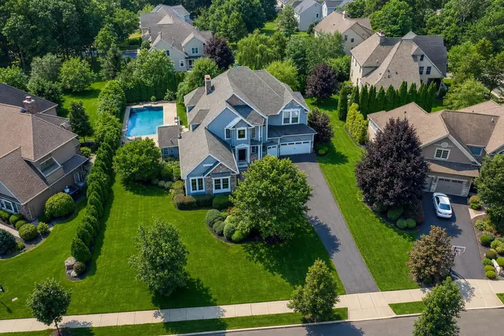
Aerial shots are especially helpful for properties with wide lots, multiple outdoor areas, long driveways, or dramatic landscaping. In New Jersey, detached homes with generous parcels frequently benefit, as drones can connect details like pools, patios, and wooded boundaries within a single comprehensive view. This type of visual context is often difficult to achieve from the ground alone.
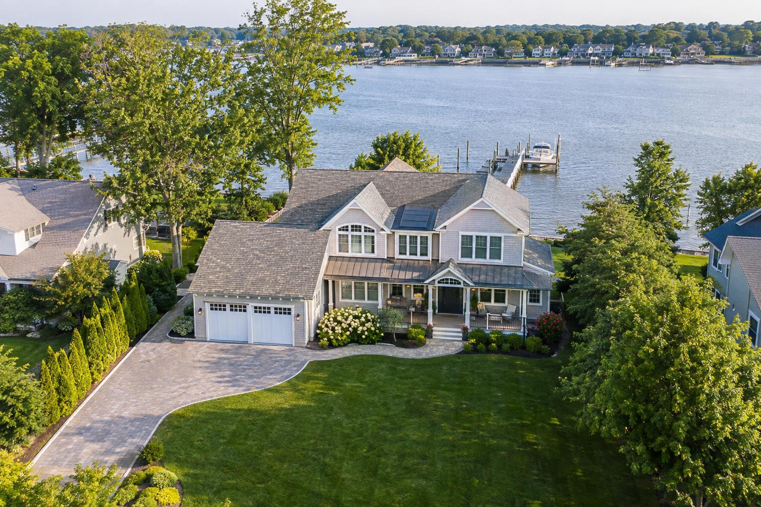
Waterfront homes and shore-area listings are another strong fit for drone media. While street-level photos might capture a nice view or a dock, only an aerial shot can fully show the relationship between the property and the water. Potential buyers can see how the home interacts with the shoreline, the scale of water frontage, and access to walkways or neighboring beaches.
Why Agents Choose RealtaSnap
- Distinctive rooflines and architectural layouts also lend themselves to aerial coverage, giving a sense of shape and design that’s invisible from the street. If a property’s curb appeal relies on a wraparound porch, modern addition, or dramatic building form, a carefully composed drone image can provide useful perspective. The effectiveness depends on choosing angles that spotlight the property’s actual features.
- Notably, corner lots and homes positioned next to parks or at the edge of a neighborhood often benefit from an aerial overview. This approach helps buyers see entrances, green spaces, or dual street frontage, making unique positioning more understandable. However, the decision should always center on whether the aerial image adds real clarity, not just novelty.
- For commercial properties, land, or development sites, drone imagery is especially practical. Aerial media can show boundaries, approaches, parking, and connections to retail or transportation corridors. While these images aren’t substitutes for boundary surveys or site plans, they do help potential buyers visualize opportunities and challenges more effectively from the outset.
Fast Turnaround and Better Results
There are situations where aerial photography isn’t the most effective use of a marketing budget. Apartments that focus on renovated interiors, buildings closely surrounded by other structures, or homes with limited exterior features usually don’t gain much from drone coverage. In such cases, high-quality interior and ground-level exterior images may tell the story best.
It’s worth noting that drone photography in NYC presents unique challenges, from strict airspace regulations to practical access limitations. Dense neighborhoods, heavy foot traffic, and limited rooftop areas make aerial work more selective in Manhattan and Brooklyn. Sometimes roof access helps, but often standard exteriors and video walkthroughs remain more feasible and useful.
RealtaSnap assesses each property on a case-by-case basis when it comes to drone media. Flight feasibility depends on FAA guidelines, weather, safety, access, and authorization. The company does not handle municipal or special event permits, so projects requiring those permits are not accepted. Early conversations should include the property address and the features needing aerial attention, so feasibility can be evaluated promptly.
For listings that merit aerial coverage, clients can choose from focused option sets like 10 HDR photos, a one-minute 4K drone video, or a photo-plus-video package. Providing the property address during booking allows the RealtaSnap team to consider all operational factors up front. All prices and information are subject to change. Information is deemed reliable but not guaranteed.
Ready to Elevate Your Next Listing?
Ready to get started? Visit RealtaSnap to explore our services and book your next shoot.
Frequently Asked Questions
How do I know if drone photography will actually help market my listing?
If the aerial view highlights property features that ground-level shots can’t capture, it’s usually worth considering; if not, you may want to focus on interiors or basic exterior photos.
What factors determine if an aerial shoot is possible at my location?
Drone feasibility is based on FAA rules, airspace restrictions, weather, safe access, authorization, and pilot discretion; not every property will qualify for flight.
Can I get both drone photos and video in one package?
Yes, RealtaSnap offers a combined package that includes both aerial HDR photos and a one-minute 4K drone video when conditions allow.